
Los Angeles becomes easier to understand when you stop asking how many famous places will fit into a day. The city is not a compact stage set. It is a wide, polycentric place made of districts, independent neighboring cities, mountain edges, coastal communities, rail corridors, freeways, river infrastructure, and working landscapes. The most useful plan is therefore not a checklist. It is an edit: one anchor, one compatible change of scene, and enough time to notice what connects them.
That principle works whether you begin downtown, near the beach, below Griffith Park, along the river, or at the harbor. A good day changes scale without becoming a race. A tiled station hall can lead to a civic plaza and a market. A dense commercial corridor can give way to a park ridge. A quiet canal can open onto the Pacific. A bridge view can reveal how industry, rail, flood control, public space, and neighborhoods share the same corridor.

Full-Day Iconic Sights of LA, Hollywood, Beverly Hills, Beaches and More
This 7.5 hour guided tour - by LA-natives - is perfect for families, couples and all ages! Our routes are carefully curated to visit the most welcomin...

Warner Bros. Studio Tour Hollywood
Our Studio Tour brings you closer than ever to the entertainment you love. You’ll explore one of the busiest worki...
Hollywood, Beverly Hills & Celebrity Homes Tour by Open Air Bus
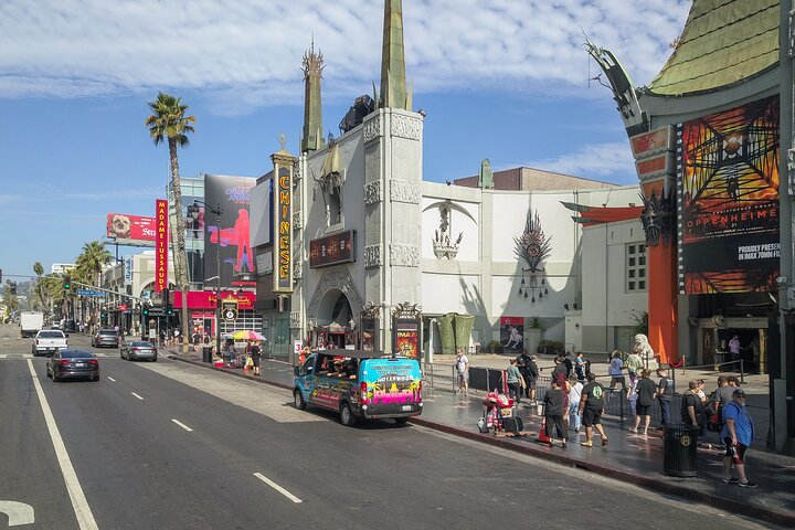
Your Ticket to The Hollywood Hills on this Interactive Sightseeing Tour on an Open Air Bus with a Fun Driver Guide...

Best of Los Angeles Guided City Tour with 4 Stops and Free Time
Check out the BEST Los Angeles has to offer on this half-day interactive sightseeing experience! Take a seat on one...
This guide offers a planning framework, not a timed itinerary. Current transit service, road conditions, hours, reservations, closures, air quality, fire conditions, beach warnings, and accessibility details can change. Check the responsible official source close to departure and keep a shorter alternative in the same part of the city.
Begin with the map you actually have
Many first-time plans underestimate Los Angeles because a flat screen removes terrain, traffic, transfer time, and the difference between municipal boundaries. “Los Angeles” can mean the City of Los Angeles, the county, or the wider metropolitan region. Those are not interchangeable. Santa Monica, for example, is an independent city; Long Beach is another. Destinations described together in travel media may be separated by substantial distance even when both use a Los Angeles postal address.
Start by pinning the exact places you care about. Then look at their relationship rather than their fame. Are they on the same rail line? Do they share a district or adjoining districts? Does the route cross a mountain pass, a freeway bottleneck, or most of the basin? Could the second place be replaced by something nearby that deepens the same story?
A coherent plan usually has four parts:
- An anchor: the district, museum, landscape, market, performance, or appointment that matters most.
- A connective spine: a rail line, bus corridor, walkable street sequence, or deliberately chosen drive.
- A scene change: one contrasting place that can be reached without consuming the day.
- A release valve: an optional stop that can disappear if heat, traffic, energy, or timing changes.
The anchor protects the day from becoming generic. The spine makes the distance legible. The scene change supplies the distinctively Los Angeles moment. The release valve keeps the plan humane.
Choose a scene family
Instead of organizing the city only by top attractions, group possibilities by the kind of transition you want to experience. The following families are not official boundaries. They are practical editorial frames for keeping a day connected.
Downtown rooms and civic edges
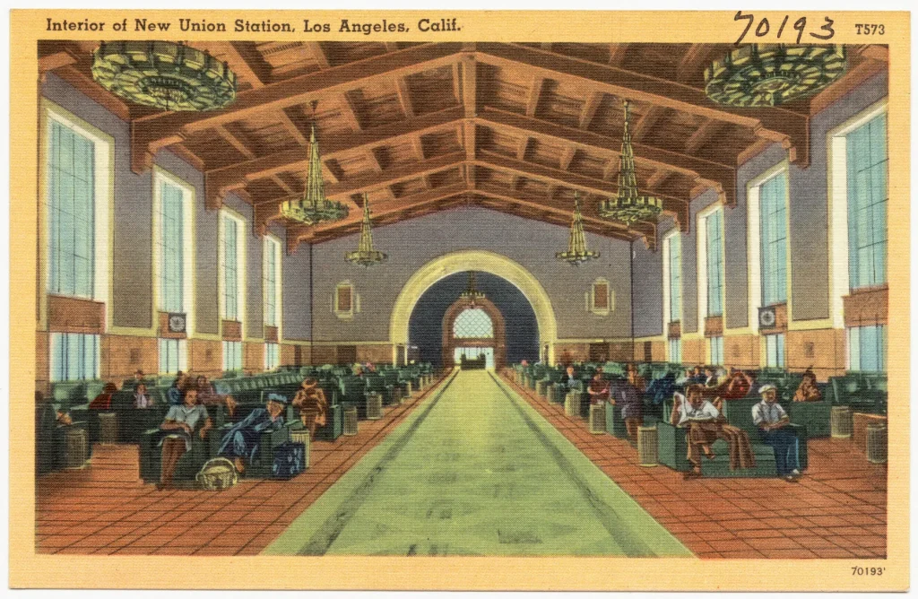
Union Station, El Pueblo, the Civic Center, Broadway, Grand Central Market, and nearby cultural institutions can form a day in which architecture and public movement do much of the storytelling. The distances can be manageable, but the quality of each block changes quickly. Treat the route as a sequence of rooms: a station waiting hall, an open plaza, a market aisle, a theater façade, a contemporary cultural interior.
Choose operating institutions based on current official information. Do not assume that every historic interior is open, every entrance is active, or every block offers the same pedestrian comfort. If a planned venue closes, keep the day downtown rather than replacing it with a beach across the city.
Hills, park, and basin view
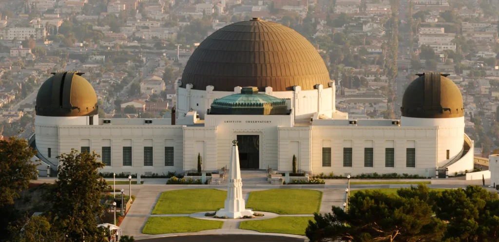
Griffith Park and its surroundings provide one of the clearest changes in scale: urban streets below, park terrain above, and the basin spreading outward. The park is large, conditions vary, and a familiar view is not a guarantee. Heat, haze, trail closures, parking pressure, and event schedules can alter the experience.
Build the day around the official destination and a nearby district rather than attaching several remote landmarks. A morning or late-day park visit can pair with Los Feliz, Thai Town, East Hollywood, or another nearby corridor depending on the exact route and current service. Check the official Griffith Observatory and park information before setting out.
Westside waterlines
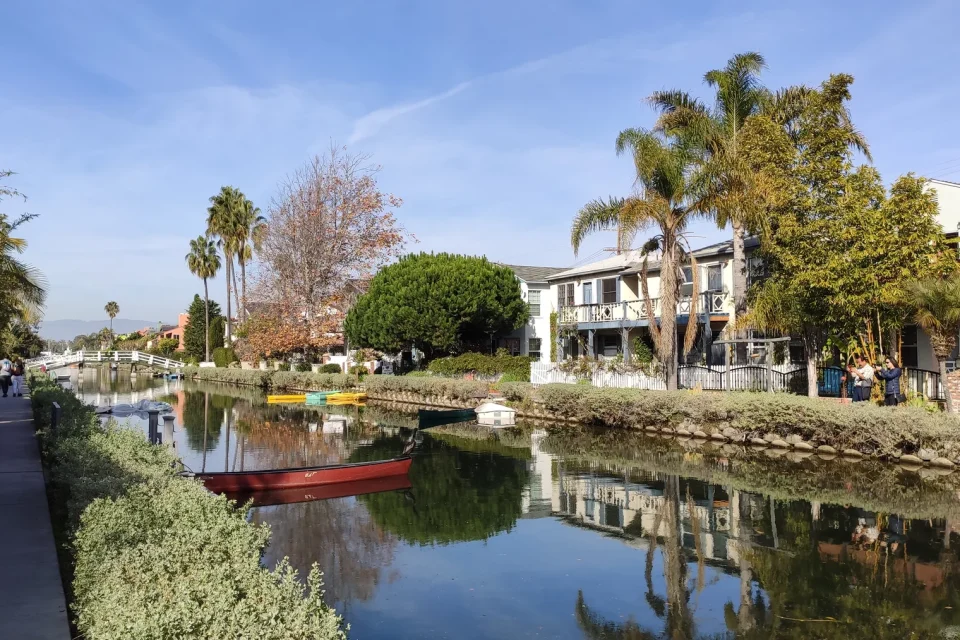
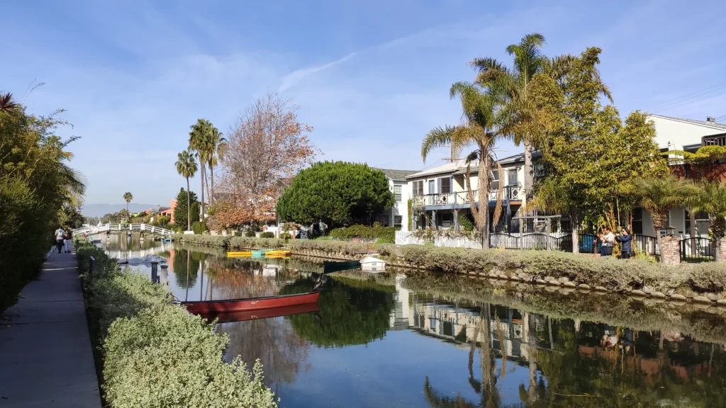
Venice offers several adjacent scenes: residential canals, a commercial street, the beach, and the oceanfront. They are close enough to connect on foot, yet they should not be collapsed into one mood. The canal district is residential and asks for ordinary courtesy. The oceanfront is a busy public space with a different rhythm. The beach itself changes with weather, surf, wind, and seasonal conditions.
If Venice is the anchor, let the Pacific be the day’s large release. Adding distant inland landmarks can erase the benefit of being near the coast. Confirm beach and transportation conditions with the relevant public agencies.
Still comparing Sightseeing?
Ask for tour ideas, hotel suggestions, or a simple trip plan that combines both.
Trip Helper
River, bridges, and industrial ground
The Los Angeles River is not a single park experience. Different reaches have different access, land use, paths, habitat, infrastructure, and adjacent communities. A river-focused day should identify the exact segment and managing information rather than following a vague “river” label.
The value of this scene family is the relationship among channel, bridges, rail, industry, habitat work, and new public ambitions. It is also a place where access assumptions can fail. Use current public information, stay in authorized areas, and do not treat working or restricted land as an invitation to explore.
Harbor and maritime city
San Pedro reveals a Los Angeles many short itineraries omit: a working waterfront, maritime history, port infrastructure, coastal overlooks, and communities shaped by the harbor. It is far from many inland anchors, so it works best as the center of its own day.
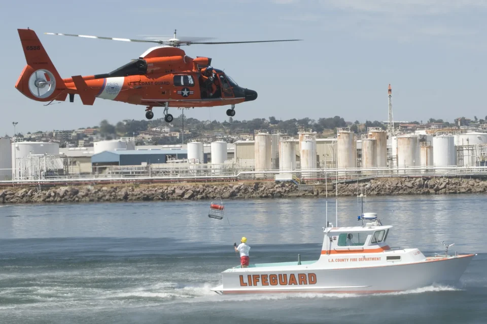
The Port of Los Angeles is active infrastructure. Viewpoints, museums, waterfront spaces, and excursion services have specific hours and conditions. Confirm those details independently and leave restricted operations alone. The reward is not a checklist of ships; it is understanding the city’s connection to global trade, labor, migration, defense, fishing, recreation, and the Pacific.
Let transit reveal the city, without romanticizing it
Los Angeles has a growing rail and bus network, but no single mode solves every trip. Metro can make certain district combinations much clearer, while other routes require a bus connection, a long walk, a bicycle segment, a rideshare, or a car. Service patterns and station access can change, so use the official Metro planner near departure rather than relying on an old article.
Transit is useful not only because it moves you. It shows the spaces between named destinations. An elevated or at-grade view can expose industrial blocks, residential streets, river infrastructure, mountain lines, and the repeated geometry of the basin. A bus corridor can make the transition between districts legible at street level.
Keep expectations practical:
- Check the complete route, including the first and last walking segments.
- Look for planned service changes and the final return option.
- Confirm fare media and transfer rules with Metro.
- Do not assume every station entrance or elevator is operating.
- Keep water, sun protection, and a charged phone without displaying valuables carelessly.
- If a person in your group has mobility requirements, verify the exact accessible path rather than inferring it from a station symbol.
Driving requires similar realism. A short geographic distance can still be a poor pairing at a particular time. Parking rules vary, curb signs matter, valet cost is not universal, and event traffic can transform a route. Build margin around reservations and never promise an arrival time based on distance alone.
Use light and climate as design constraints
Los Angeles is often described through light, but practical conditions matter more than a cinematic cliché. Summer heat can make an exposed midday walk unwise. Marine air can cool the coast while inland districts remain hot. Wildfire smoke can reduce air quality far from a visible fire. Winter rain can affect trails, roads, and river conditions. Haze may remove a long view without removing the value of the place.
Plan exposed landscapes for the appropriate time of day, carry water, and check official weather and air-quality information. If conditions make an outdoor anchor unsuitable, move to a nearby indoor counterpart rather than crossing the city for a replacement. Downtown architecture can shift into a museum or market. A Griffith-area plan can become a neighborhood and cultural-institution day. A coastal plan can shorten to a sheltered corridor while preserving the westside focus.
The best backup changes the texture, not the geography.
Four sample frameworks
These are structures rather than schedules. Confirm every current detail before using them.
| Starting idea | Anchor | Compatible scene change | What to leave optional |
|---|---|---|---|
| Arrival and architecture | Union Station and a downtown civic route | Grand Central Market or a current cultural venue | A distant evening reservation |
| Basin and hills | Griffith Observatory or a specific park route | A nearby neighborhood corridor | A cross-city beach run |
| Canal to horizon | Venice Canal Historic District | Venice Beach and the Pacific edge | An inland museum far from the westside |
| Working waterfront | A confirmed San Pedro waterfront destination | Maritime history or a nearby coastal overlook | Downtown Los Angeles on the same day |
Framework one: station to market
Begin at Union Station only after confirming the route and any venue plans. Notice how arrival is staged through materials, waiting spaces, courtyards, and thresholds. Move toward a civic or historic stop that is actually open, then continue to Grand Central Market. The useful scene change is not distance; it is the shift from monumental room to public street to compressed food hall.
Make one cultural institution optional. Downtown contains enough layers that losing a stop should not collapse the day. If you are attending a performance or timed exhibition, reverse the plan so the appointment is the anchor and walking becomes the flexible material around it.
Framework two: neighborhood to ridge
Choose the exact Griffith Park destination first. A trail, the Observatory, and another park facility are not equivalent in access or effort. Pair it with one nearby district where you can slow down before or after the exposed landscape. The scene change comes from vertical release: close street frontage below, broad basin view above.
Avoid turning the ridge into a photo deadline. Visibility changes. The park’s terrain, buildings, planted edges, and relationship to the street grid remain meaningful even when the horizon is muted.
Framework three: quiet water to open water
Begin at the Venice canals with residential respect. Keep voices ordinary, avoid blocking bridges and paths, and do not treat homes as sets. Move toward a commercial corridor for a meal or pause, then continue to the oceanfront and beach if conditions support it.
The day works because the water changes character: narrow, designed canals; active street; broad public edge; open Pacific. Keep the route compact and let wind, surf, heat, and crowd levels determine how long the final scene lasts.
Framework four: harbor as the main city
Treat San Pedro as a destination rather than an add-on. Choose one verified waterfront, museum, excursion, or maritime-history anchor and understand its operating requirements. Add a nearby viewpoint or public space only if access is clear. Notice the relationship between neighborhood streets and port scale without entering restricted areas or obstructing work.
This framework makes geographic honesty especially important. A port seen from a legal public viewpoint is still working infrastructure. The editorial goal is context, not access at any cost.
Make room for culture without turning it into décor
Los Angeles has no single “authentic” food, music, art, or neighborhood experience. Such labels often erase the people and institutions that give a place meaning. Use named sources. Identify the artist, organization, market, historic district, cultural institution, or business when a claim depends on them. Check whether a mural or cultural site has community-produced interpretation. Ask before photographing people at close range, especially workers and vendors.
Food planning benefits from the same editing principle. A meal should fit the district rather than justify an hour of cross-city travel because a ranking said it was essential. Verify hours and ordering practices directly. A market is not a generic collection of photogenic stalls; it is a working place with circulation, regular customers, vendors, delivery routines, and rules.
When you do travel specifically for a restaurant or event, make it the anchor. Build the rest of the day nearby.
Evaluate tours and products honestly
A guided experience may add value when interpretation, access, transportation, or specialist knowledge is central. Compare only real inventory returned by an authorized provider. A card should preserve the provider’s title, price, rating, review count, tracking, availability, and destination link. If the feed returns nothing, an honest empty state is better than a fabricated recommendation.
Before booking, check:
- the exact start and end locations;
- what transportation, admission, food, or equipment is included;
- walking distance, terrain, heat exposure, and accessibility;
- age, health, identification, or mobility requirements;
- cancellation and weather terms;
- the operator named on the booking page; and
- whether the timing fits your real transfer before and after the experience.
Los Angeles Trip Guide may shape the presentation of authorized provider results, but it does not control the provider’s live inventory or policies.
Plan access as a route, not a label
An accessible entrance does not guarantee an accessible journey from the curb, station, parking space, or previous stop. Terrain, broken elevators, surface conditions, heat, distance, seating, restrooms, and crowding all matter. Ask the responsible venue or agency about the exact route you need.
For a mixed-mobility group, choose an anchor with clear current information and build the scene change around a short, adjustable connection. Save the address of the accessible entrance. Confirm whether a mobility device, service animal, sensory accommodation, or companion arrangement requires advance notice. Do not rely on a photograph to infer grade or access.
The same principle applies to families and older travelers. A day with fewer transfers and a dependable pause can reveal more of the city than an ambitious route that leaves no recovery time.
A final scene-change checklist
Before leaving, ask:
- Can I name the one anchor that makes this day worthwhile?
- Is the second scene connected by geography or a clear transit spine?
- Have I checked the official source for every time-sensitive detail?
- Do I understand the first and last part of the route?
- Is there enough margin for traffic, transfers, heat, or a slower meal?
- Does the plan still work if the long view disappears?
- Have I kept one stop optional?
- Am I representing the district as a living place rather than a backdrop?
- Do I have a same-area alternative for weather, closure, or fatigue?
- Can I return without depending on a fragile final connection?

Los Angeles 3-Hour City Tour with 3 Stops
Experience Los Angeles on a personalized sightseeing tour unlike the typical scripted experience. Your knowledgeable local guide will share fascinatin...

Small-Group City Tour of Los Angeles, Hollywood and Beverly Hills
Discover the best of Los Angeles, Hollywood, & Beverly Hills on this immersive multimedia sightseeing tour—perfect...

Los Angeles Hollywood Sign Hike: Front, Behind, and Expert Guide
Featured by the New York Times, The Today Show, USA Today, and the LA Times — Bikes and Hikes LA is LA's most trus...

Catalina Island Private Guided Golf Cart Tour of Avalon
Catalina Island’s original custom guided golf cart tour! Explore Avalon through the eyes of a local. With us you w...
Los Angeles does not need to be conquered in a weekend. It needs to be edited at the scale of a real day. Choose the scene carefully, let one turn change it, and leave the rest of the city for another route.