The Los Angeles River should not be planned as one continuous attraction. Its reaches differ in channel form, adjacent land use, habitat, paths, public access, and managing information. A responsible visit begins with an exact segment and current official guidance.
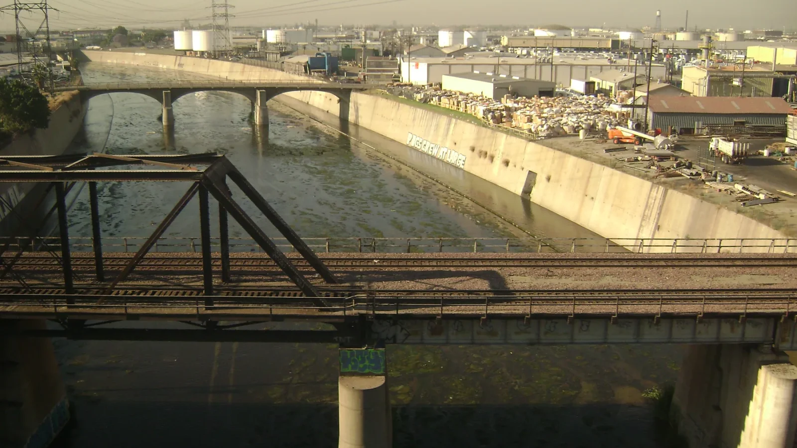
The river tells several stories at once: flood-control engineering, rail and road crossings, industrial land, neighborhood edges, habitat work, public-space projects, and changing ideas about what an urban river can be. Those layers are visible without entering restricted land or treating working infrastructure as abandoned scenery.

Full-Day Iconic Sights of LA, Hollywood, Beverly Hills, Beaches and More
This 7.5 hour guided tour - by LA-natives - is perfect for families, couples and all ages! Our routes are carefully curated to visit the most welcomin...

Warner Bros. Studio Tour Hollywood
Our Studio Tour brings you closer than ever to the entertainment you love. You’ll explore one of the busiest worki...
Hollywood, Beverly Hills & Celebrity Homes Tour by Open Air Bus
Your Ticket to The Hollywood Hills on this Interactive Sightseeing Tour on an Open Air Bus with a Fun Driver Guide...

Best of Los Angeles Guided City Tour with 4 Stops and Free Time
Check out the BEST Los Angeles has to offer on this half-day interactive sightseeing experience! Take a seat on one...
Choose the segment before the route
Identify the legal public access point, the condition of the path, the distance, and the return. Check heat, air quality, rain, and any closure notices. River conditions after storms require particular caution. Do not assume a concrete channel is safe to enter or cross.
A bridge viewpoint can reveal how transportation systems overlap. A path section may foreground vegetation and habitat. Another reach may be dominated by industry. Describe the place in front of you rather than applying one image to the entire river.
Bring context, not conquest
Photography should stay within legal public space and avoid obstructing workers, cyclists, or residents. Rail corridors and industrial sites have real hazards and access restrictions. A telephoto view does not create permission to enter.

Los Angeles 3-Hour City Tour with 3 Stops
Experience Los Angeles on a personalized sightseeing tour unlike the typical scripted experience. Your knowledgeable local guide will share fascinatin...

Small-Group City Tour of Los Angeles, Hollywood and Beverly Hills
Discover the best of Los Angeles, Hollywood, & Beverly Hills on this immersive multimedia sightseeing tour—perfect...

Los Angeles Hollywood Sign Hike: Front, Behind, and Expert Guide
Featured by the New York Times, The Today Show, USA Today, and the LA Times — Bikes and Hikes LA is LA's most trus...

Catalina Island Private Guided Golf Cart Tour of Avalon
Catalina Island’s original custom guided golf cart tour! Explore Avalon through the eyes of a local. With us you w...
Pair the river with a nearby district, park, or cultural institution whose current access you have confirmed. Keep the route geographically tight. The scene change should deepen the river story—perhaps from channel to neighborhood street—not convert the day into another cross-basin checklist.